


- Could you briefly introduce yourself and tell us about your role in the development of the First Mauritius Atlas of Terrestrial Ecosystems?
- I was born in Mauritius in 1985 and pursued engineering studies in Australia, then a Masters in Sustainability Leadership in Sweden. I’ve returned to Mauritius in 2011 where I’ve had various professional roles. The First Mauritius Atlas of Terrestrial Ecosystems is an outcome of my PhD research at UDM, which I started in 2022.
- What inspired you to work on the Atlas, and why was it important to develop such a comprehensive mapping of Mauritius’ terrestrial ecosystems?
- The idea of an Atlas came about as I worked on natural capital accounting. Following the UN statistical standard, this led me to use various types of geospatial data and to produce various maps. Since maps are a form of information that people comprehend relatively easily, we thought an Atlas would be a great way to disseminate results.
- The Atlas provides the first spatialised accounts of ecosystem extent and condition for Mauritius. Could you explain what this means in simple terms for the general public?
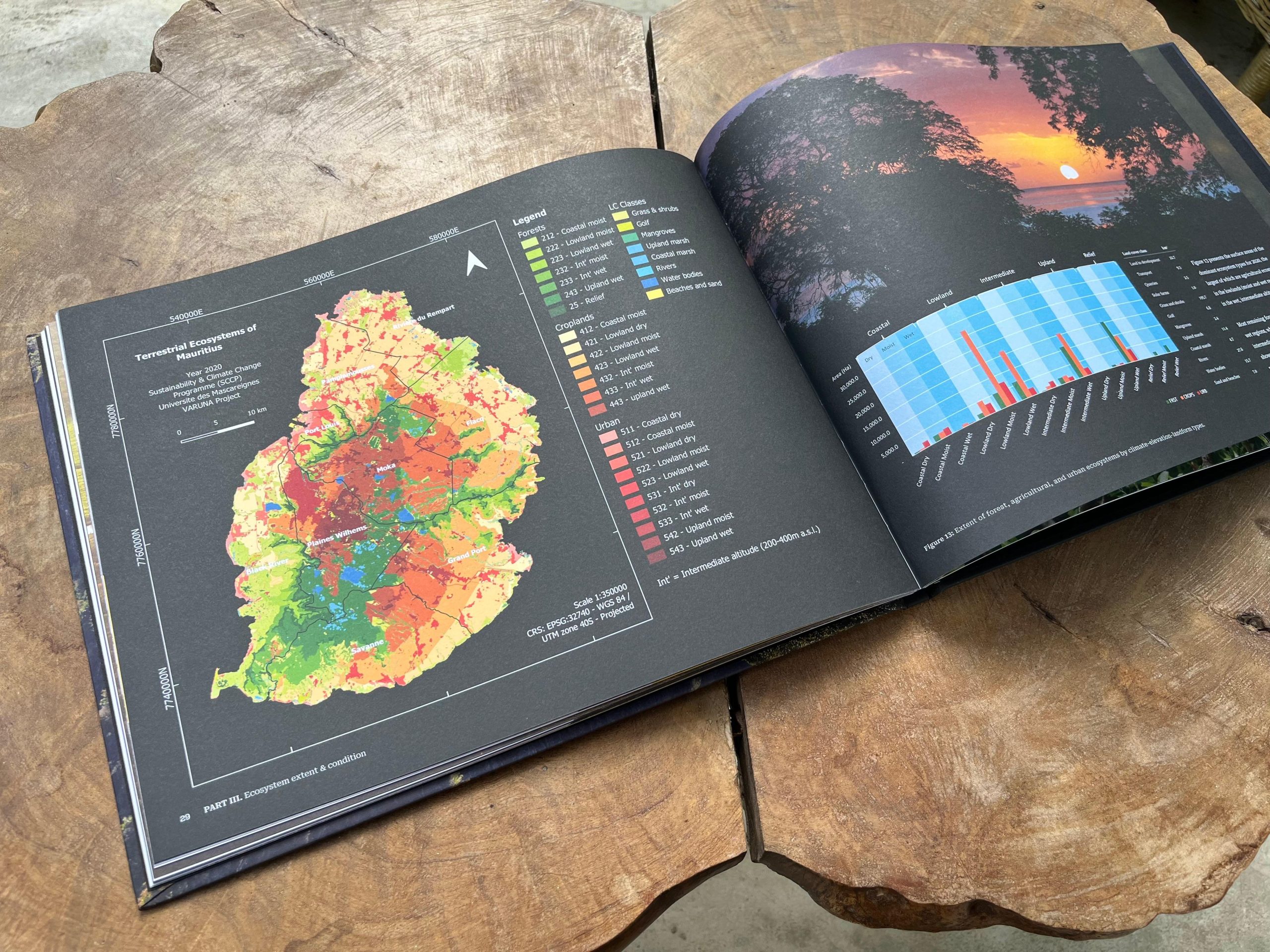
- “Extent” means the surface area occupied by different ecosystems on the island. There are different categories, for example forest ecosystems, agricultural ecosystems, and even urban ecosystems. These are broken down into sub-categories in terms of their altitude or terrain type (like steep slopes, mountains, ravines, etc.) and climatic characteristics (like dry and humid regions).
- “Condition” describes their “quality”, or the state they are in compared to a reference state, usually an undisturbed, natural state. This is represented on a scale of zero to 1, where 1 is the natural state. To illustrate where we were in 2020: the best-preserved district (Savanne) only had a score of 0.42 out of 1. The lowest-scoring was Riviere du Rempart (0.24 out of 1).
- What was the most challenging aspect of developing the Atlas, and how did you overcome it?
- The most challenging was executing the ecosystem accounting and mapping itself, as I had never worked with GIS (geographical information systems) before. There were data gaps to fill, other data to obtain and process in a meticulous way, and even if there is a UN standard to follow, it doesn’t give you a step-by-step guide for GIS operations. The learning curve was very steep: it took me 1 year to produce landcover maps, and at first, I computed condition indicators by watersheds as ecological units – this was wrong because a watershed can contain different ecosystems. I had to go back to the literature and find the right way to identify ecosystems, compute the condition indicators, and finally the aggregated condition scores in a map format. I made many mistakes along the way but managed to resolve them by testing different operations, re-checking and refining the process, until everything was coherent and aligned with the standard. In the end there is no secret, it’s all about putting the hours (days, months, years) into it.
- How can the Atlas support the Government, planners, landowners and other stakeholders in making informed decisions about land use, conservation and ecosystem restoration?
- Mauritius is party to the Rio Conventions, meaning the UN conventions on climate change (UNFCCC), biodiversity (CBD), and to combat desertification or in our case, the loss of productive land (UNCCD). Mauritius is also committed to implementing the Sustainable Development Goals (SDGs), which include targets aligned with the Rio Conventions. The Atlas provides information that is pertinent to all of those: natural ecosystems store more carbon and protect communities from climate-related risks such as flooding; they are habitats for our unique biodiversity, and healthy landscapes support agricultural production and food security.
- The Atlas gives an overview of the state of nature on our island. It shows where the different types of ecosystems are, where they are, and what state they are in at different scales: the map pixel (10m resolution), the district, and the municipal and village council area. This can help to guide land use decisions – to avoid degrading ecosystems in good condition, or to preserve the healthiest agricultural lands. It can also guide resource allocation – to channel restoration efforts to degraded areas. This kind of prioritization is not possible without such a comprehensive assessment.
- In this context, we can also explore how ecosystem information can support compensation mechanisms: if land conversions degrade ecosystems in a given site, restoration of another site can be made mandatory. This is the principle of the new Biodiversity Net Gain regulation in the UK, a legal framework that mobilizes key stakeholders around the concept of “Nature Positive” development.
- From a research perspective, what makes the Atlas particularly significant for Mauritius and potentially for other island states?
- Our island has been actively transformed since colonization and is in a state where we should (and can) begin to restore its ecosystems, in accordance with international commitments and for our own benefit. The Atlas, and additional ecosystem accounting results, is a decision-support tool towards this objective. What is particularly interesting is that we can use the data as a baseline for different land use scenarios and explore how these would impact ecosystems in the future, both in terms of extent and condition, but also in terms of ecosystem services. This would allow us to test interventions and potentially estimate their costs and benefits, both financially and for the economy in a broader sense.
- What has this project taught you personally as a PhD student and researcher?
- It taught me many things, and I don’t think I can relate all of them here. Perhaps most strikingly, there are incredible tools, data, and methods out there that allow us to evaluate things we couldn’t (or didn’t know how to) quantify before. It’s just a matter of putting in the effort and building the capacity to use them. Then, insights must find a way into the mainstream knowledge base. Many studies are valuable but haven’t been disseminated enough to generate real impact. They “stay in a drawer”, as the saying goes. The information must make its way into public and private governance mechanisms.
- What are the next steps for this research?
- There are many avenues and tangents we can explore. For instance, compensation mechanisms as mentioned above. I also started working on the correlation between ecosystem condition and flood risk, which is relevant to Nature-based Solutions and the insurance industry. We can also enrich the Atlas with additional indicators, like the distribution of plant and animal species.
- Finally, what message would you like to share with students and young researchers who are interested in biodiversity, environmental science and climate-related research?
- In this work, it’s important to have a specialty that keeps us driven, yet for it to be impactful, we must also learn (at least some of) the language from different fields (ecology, finance, policy) to make our contribution relevant across disciplines.

2026-10-07 10:39:32
- Could you briefly introduce yourself and tell us about your role in the development of the First Mauritius Atlas of Terrestrial Ecosystems?
- I was born in Mauritius in 1985 and pursued engineering studies in Australia, then a Masters in Sustainability Leadership in Sweden. I’ve returned to Mauritius in 2011 where I’ve had various professional roles. The First Mauritius Atlas of Terrestrial Ecosystems is an outcome of my PhD research at UDM, which I started in 2022.
- What inspired you to work on the Atlas, and why was it important to develop such a comprehensive mapping of Mauritius’ terrestrial ecosystems?
- The idea of an Atlas came about as I worked on natural capital accounting. Following the UN statistical standard, this led me to use various types of geospatial data and to produce various maps. Since maps are a form of information that people comprehend relatively easily, we thought an Atlas would be a great way to disseminate results.
- The Atlas provides the first spatialised accounts of ecosystem extent and condition for Mauritius. Could you explain what this means in simple terms for the general public?
- “Extent” means the surface area occupied by different ecosystems on the island. There are different categories, for example forest ecosystems, agricultural ecosystems, and even urban ecosystems. These are broken down into sub-categories in terms of their altitude or terrain type (like steep slopes, mountains, ravines, etc.) and climatic characteristics (like dry and humid regions).
- “Condition” describes their “quality”, or the state they are in compared to a reference state, usually an undisturbed, natural state. This is represented on a scale of zero to 1, where 1 is the natural state. To illustrate where we were in 2020: the best-preserved district (Savanne) only had a score of 0.42 out of 1. The lowest-scoring was Riviere du Rempart (0.24 out of 1).
- What was the most challenging aspect of developing the Atlas, and how did you overcome it?
- The most challenging was executing the ecosystem accounting and mapping itself, as I had never worked with GIS (geographical information systems) before. There were data gaps to fill, other data to obtain and process in a meticulous way, and even if there is a UN standard to follow, it doesn’t give you a step-by-step guide for GIS operations. The learning curve was very steep: it took me 1 year to produce landcover maps, and at first, I computed condition indicators by watersheds as ecological units – this was wrong because a watershed can contain different ecosystems. I had to go back to the literature and find the right way to identify ecosystems, compute the condition indicators, and finally the aggregated condition scores in a map format. I made many mistakes along the way but managed to resolve them by testing different operations, re-checking and refining the process, until everything was coherent and aligned with the standard. In the end there is no secret, it’s all about putting the hours (days, months, years) into it.
- How can the Atlas support the Government, planners, landowners and other stakeholders in making informed decisions about land use, conservation and ecosystem restoration?
- Mauritius is party to the Rio Conventions, meaning the UN conventions on climate change (UNFCCC), biodiversity (CBD), and to combat desertification or in our case, the loss of productive land (UNCCD). Mauritius is also committed to implementing the Sustainable Development Goals (SDGs), which include targets aligned with the Rio Conventions. The Atlas provides information that is pertinent to all of those: natural ecosystems store more carbon and protect communities from climate-related risks such as flooding; they are habitats for our unique biodiversity, and healthy landscapes support agricultural production and food security.
- The Atlas gives an overview of the state of nature on our island. It shows where the different types of ecosystems are, where they are, and what state they are in at different scales: the map pixel (10m resolution), the district, and the municipal and village council area. This can help to guide land use decisions – to avoid degrading ecosystems in good condition, or to preserve the healthiest agricultural lands. It can also guide resource allocation – to channel restoration efforts to degraded areas. This kind of prioritization is not possible without such a comprehensive assessment.
- In this context, we can also explore how ecosystem information can support compensation mechanisms: if land conversions degrade ecosystems in a given site, restoration of another site can be made mandatory. This is the principle of the new Biodiversity Net Gain regulation in the UK, a legal framework that mobilizes key stakeholders around the concept of “Nature Positive” development.
- From a research perspective, what makes the Atlas particularly significant for Mauritius and potentially for other island states?
- Our island has been actively transformed since colonization and is in a state where we should (and can) begin to restore its ecosystems, in accordance with international commitments and for our own benefit. The Atlas, and additional ecosystem accounting results, is a decision-support tool towards this objective. What is particularly interesting is that we can use the data as a baseline for different land use scenarios and explore how these would impact ecosystems in the future, both in terms of extent and condition, but also in terms of ecosystem services. This would allow us to test interventions and potentially estimate their costs and benefits, both financially and for the economy in a broader sense.
- What has this project taught you personally as a PhD student and researcher?
- It taught me many things, and I don’t think I can relate all of them here. Perhaps most strikingly, there are incredible tools, data, and methods out there that allow us to evaluate things we couldn’t (or didn’t know how to) quantify before. It’s just a matter of putting in the effort and building the capacity to use them. Then, insights must find a way into the mainstream knowledge base. Many studies are valuable but haven’t been disseminated enough to generate real impact. They “stay in a drawer”, as the saying goes. The information must make its way into public and private governance mechanisms.
- What are the next steps for this research?
- There are many avenues and tangents we can explore. For instance, compensation mechanisms as mentioned above. I also started working on the correlation between ecosystem condition and flood risk, which is relevant to Nature-based Solutions and the insurance industry. We can also enrich the Atlas with additional indicators, like the distribution of plant and animal species.
- Finally, what message would you like to share with students and young researchers who are interested in biodiversity, environmental science and climate-related research?
- In this work, it’s important to have a specialty that keeps us driven, yet for it to be impactful, we must also learn (at least some of) the language from different fields (ecology, finance, policy) to make our contribution relevant across disciplines.